Analyzing the Forecast Accuracy of Hurricane Ian's Path
Written on
Chapter 1: Understanding Hurricane Forecasting
Forecasting hurricane paths involves a complex interplay of various models that aim to predict the future trajectory of storms. The National Hurricane Center (NHC) utilizes numerous forecasting models to create a consensus cone of uncertainty for tropical systems. However, there are instances when models struggle to align, leaving both local authorities and the public in a state of uncertainty regarding a hurricane's potential path. This was notably the case with Hurricane Ian.
In the lead-up to Ian’s devastating landfall, the NHC warned of significant unpredictability in the storm's trajectory. Multiple macro factors were at play, complicating accurate predictions. These factors included a persistent trough over the northern U.S., a subtropical ridge to the east, rising high pressure over Texas, the emergence of another trough in the Gulf of Mexico, and wind shear affecting the storm's development from the west. The myriad interactions among these variables led to conflicting model outputs, meaning that minor changes could drastically alter predictions.
Following Ian's unexpected landfall near Fort Myers Beach—much farther south than anticipated—there will be extensive discussions at the NHC to analyze the forecasting process. Among the models, one stood out for its accuracy in predicting the hurricane's path.
Section 1.1: A Closer Look at the Models
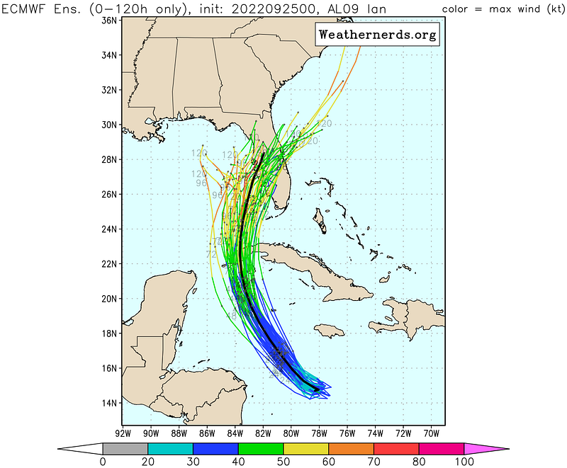
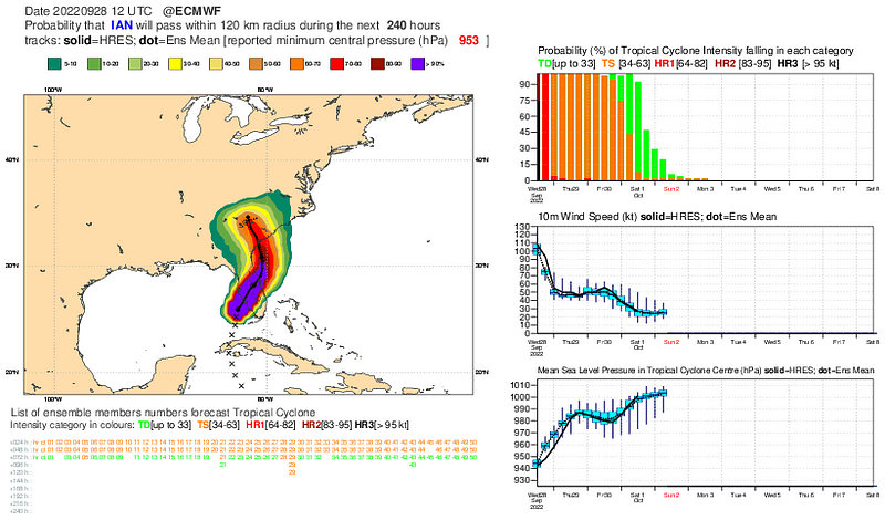
The European Centre for Medium-Range Weather Forecasts (ECMWF) consistently demonstrated a more reliable forecast than the Global Forecasting System (GFS). On September 25th, just days before Ian struck Florida, the ECMWF indicated a track that was considerably further south, which ultimately aligned more closely with the storm's actual path. In contrast, the GFS stubbornly maintained predictions that placed the storm's impact near Tampa Bay, despite the evidence suggesting otherwise.

Even as late as September 27th, the GFS continued to project the storm's impact around Tampa, failing to account for the possibility of a trajectory that would traverse the central part of the state. The divergence in model outputs necessitated the NHC's cautious approach, but the ECMWF consistently outperformed the GFS throughout the forecast period.
Subsection 1.1.1: The GFS Model's Shortcomings
The GFS model's inaccuracies prompted the NHC to adjust its forecasts westward, ultimately misleading many residents. As a result, evacuation orders were issued for areas like Tampa Bay based on flawed data, while residents in Lee County, which includes Fort Myers, were left with insufficient time to evacuate safely.

Section 1.2: Intensity Forecasting Success
Despite the forecasting errors in tracking the storm, the NHC successfully predicted Ian's rapid intensification. As forecasters recognized the storm would evolve from a disorganized tropical system into a powerful hurricane, they displayed a keen understanding of intensity prediction—a challenging aspect of meteorology. This contrasts with past forecasting failures, such as those seen with Hurricane Michael.
Chapter 2: Lessons Learned from Hurricane Ian
Video: Troubling trends in Ian's forecast track | Recorded 1:58 p.m. 9/26
This video discusses the inconsistencies in the forecast models leading up to Hurricane Ian's landfall, emphasizing the challenges faced by meteorologists.
Video: [Tuesday] Dangerous Hurricane Ian Tracking Toward Florida; Life-Threatening Impacts Likely
This video outlines the potential impacts of Hurricane Ian on Florida, highlighting the urgency of accurate forecasting in ensuring public safety.
The aftermath of Hurricane Ian will undoubtedly lead to a reevaluation of forecasting models. As we move forward, it is crucial for these models to incorporate lessons learned from this event. The discrepancies in the GFS outputs underscored the need for improvement in accuracy, especially since many rely on these forecasts for critical decisions.

